9th-Century Scandinavia?
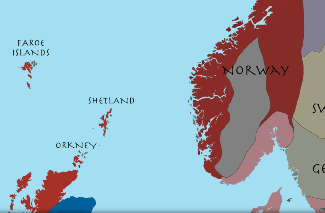
May. 30th, 2018 02:59 pmBehind the cut is a screencap from a Youtube video called 878: A Tour of Viking Britain. 
The cut tag is refusing to work for me, so I've switched to the small image above. To see the one that should be behind the cut, look here.
Does anyone here know what the gray space mostly surrounded by Norway is?
(The position of label might be read as implying the gray blob is Norway, and I should be asking about the burgundy area. But the gray blob is land-locked, and the accompanying narration is about Norwegian raiding in the Scottish islands, so I think not. It seems more likely that it's meant to be the same gray as the part of the Swedish Peninsula bounded by Sweden, Denmark, and the Straits of Denmark. The "GE" in the screencap is all the video ever shows of that label; I'm pretty sure no historian would label anyplace in 9th-Century Europe — let alone part of Scandinavia — as Germany. So the "GE" offers me no clues. Perhaps it does you?)
no subject
Date: 2018-05-31 11:59 pm (UTC)no subject
Date: 2018-06-02 09:21 pm (UTC)